First published on 03/26/2019, and last updated on 04/29/2019
By Grazia Borrini-Feyerabend, ICCA Consortium Global Coordinator
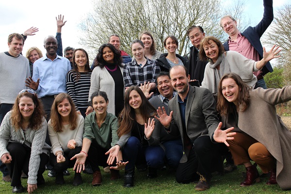
With the active support of the ICCA Consortium, WWF International and the World Conservation Monitoring Centre of UN Environment (UN Environment WCMC) organised a workshop entitled “Empowerment Mapping” in Cambridge (UK), at the end of March 2019. Several Consortium Members were invited and those who managed to secure their visas participated actively. The meeting discussed maps and mapping processes as a powerful element in self-strengthening processes for ICCAs – Territories of Life. Maps may not change much in terms of current conservation on the ground… but are an invaluable tool to enhance awareness of what exist and foster preparedness in the face of threats, hopefully leading to enhanced security of governance. This brief note does not wish to be a faithful report of all that happened in the meeting in Cambridge— it just conveys selected impressions and reflections.
What makes “a map”?
A more of less faithful representation of geomorphological reality becomes a “map” when it makes some socio-political parameters visible, in particular the existing rights and claims regarding governance that apply to given spaces and geographic/ ecological features. This highlights the variety of governance structures present in the landscape/ seascape and the topological congruence between social and ecological units. When a map permits the analysis of the overlap between governance data and spatial descriptors of environmental integrity as well as threats and dynamic processes, it indeed provides powerful insights for conservation and livelihoods.
Even more important than the map itself, the mapping process can be an element of a larger and more complex process of self-empowerment and self-strengthening (awareness, engagement, organising, communicating, networking, advocacy…) for the community custodians of ICCAs – Territories of Life.
Community land maps and maps of ICCAs – Territories of Life
Maps of both community lands and ICCAs—territories of life can be used for advocacy purposes. It should be clear, however, that they are not the same, and they do not necessarily coincide. Maps of community lands (customarily or legally-owned or governed) are grounded upon, and add visibility to, collective rights and/or claims (example: LandMark). Maps of ICCAs—Territories of Life are grounded upon, and add visibility to, collective rights and/or claims but also to freely assumed responsibilities (“the will to pursue sustainable self-determination”) (example: ICCA Registry). Thus, while maps of community lands are a representation of spaces of legality and/or legitimacy, maps of ICCAs—Territories of Life focus attention to those, but also to the ethics of custodianship and stewardship. In turn, custodianship and stewardship offer a powerful argument to recognise collective rights to govern and manage ICCAs—Territories of Life for the sake of present and future generations.
Forthcoming ambitious initiative and State of ICCAs Report
With support from the ICCA Consortium, WWF International is now developing its People Protecting Landscapes and Seascapes (PPLS) initiative— meant to dramatically improve the community relations of this major conservation organisation towards “inclusive conservation” as described in our Policy Brief no.5. The PPLS initiative has the ambition of supporting the mapping of 25 million hectares of ICCAs—territories of life by 2020 and possibly 500 million hectares by 2030. Importantly, mapping is seen just as a step in the process of securing the governance of such territories of life by their custodians. The mapping process will provide visibility to the indigenous people and local community (IPLC) organisations that have nourished the concept and practice of stewardship, and hopefully stimulate a broad-based support movement, such as the one fighting climate change. In this context, the World Resources Institute (WRI) is willing to support by coordinating a State of ICCAs Report, to be prepared by 2020 and likely to include indicative maps— not precise enough to determine land ownership boundaries but good enough to provide a baseline, predict threats, offer inspiring examples, highlight the potential for stewardship and make the case to secure ICCAs—Territories of Life. The report is expecting to spotlight 10-15 willing countries, which could also show their results at CBD COP 15 (Yunnan, China, 2020). As appropriate reporting and registering of ICCAs—territories of life requires prior processes of peer-support and peer-review, WWF International is set to promote and support such processes extensively as soon as the PPLS initiative will be formally approved (hopefully within the first 6 months of 2019). At the time of writing this note, the discussion that began in Cambridge is continuing in New York, where representatives of ICCA Consortium, WWF, WRI and many IPLCs are taking part in the UN Permanent Forum on Indigenous Issues.
The essential role of national ICCA networks
Let me leave you with the idea that the Cambridge workshop highlighted the fundamental role of national ICCA networks—comprising ICCA custodians and their allies. The networks must coordinate/ strategize/ celebrate/ share tools/ enhance mutual capacities/ peer-support and peer-review for registries at various levels. Networks are the most appropriate actors to promote and support mapping processes as they will naturally embed them into processes of self-strengthening ICCAs—territories of life and offer them coherent overall structure and meaning, in particular in terms of policy advocacy. Indeed, while seeking resources to proceed with mapping initiative, we should assess needs in terms of the national networks who will use the maps, and never in terms of the mapping processes alone.
Photo credits: Grazia Borrini Feyerabend
